Apple Valley, Utah to Zion National Park: Drive Time, Routes, and Which Entrance to Use
The paved drive from Apple Valley to Zion's south entrance takes about 50 to 55 minutes. Here's the route, when to leave, and when Kolob Canyons or the east entrance makes more sense.


In this guide
- Apple Valley to Zion at a glance
- The main route: UT-59 to Hurricane, then UT-9 to Springdale
- Getting into Zion Canyon: parking and shuttle timing
- Kolob Canyons: the closest entrance, and the quietest
- The east entrance and the Zion–Mount Carmel Highway
- Smithsonian Butte Byway: a dry-weather scenic alternative
- Which route and entrance should you use?
- Making the drive work from a cabin base
The drive from Apple Valley, Utah to Zion National Park takes about 50 to 55 minutes to the south entrance in Springdale. It’s roughly 35 miles on paved highways: UT-59 west to Hurricane, then UT-9 east through La Verkin, Virgin and Rockville. For a quieter visit, Kolob Canyons is about 45 minutes away by I-15, and the east entrance is about 1 hour 20 minutes through the park.
The first thing people ask when they book one of our cabins in Apple Valley is how far Zion really is, and we drive this road often enough to give a straight answer. You’ll see shorter estimates online, but they’re optimistic. Plan on 50 to 55 minutes in normal traffic, plus time at the entrance station in busy months.
Apple Valley to Zion at a glance
| Destination | Route | Distance | Drive time (about) |
|---|---|---|---|
| South entrance / Zion Canyon Visitor Center (Springdale) | UT-59 → Hurricane → UT-9 | 35 miles | 50–55 min |
| Kolob Canyons Visitor Center | Hurricane → La Verkin → I-15 north to exit 40 | — | 45 min |
| East entrance | South entrance, then the Zion–Mount Carmel Highway through the tunnel | — | 1 hr 20 min |
| Rockville via Smithsonian Butte Byway | UT-59 → Big Plain Junction → 9 miles of dirt | — | Not faster; FHWA estimates about 45 min for the dirt section alone |
Times assume dry roads, no construction delays and no line at the gate. On summer and holiday weekends, the entrance line alone can add a good chunk of time.
The main route: UT-59 to Hurricane, then UT-9 to Springdale
This is the route you’ll use nearly every time, and it’s an easy one. All of it is paved, two-lane highway.
- Head west on UT-59 from Apple Valley toward Hurricane. The highway drops off the high desert and down the Hurricane Cliffs into town, about 17 minutes and 12 miles from our cabins.
- Turn east onto UT-9 in Hurricane, following signs for Zion National Park and La Verkin.
- Continue through La Verkin and Virgin. The road follows the Virgin River upstream and the cliffs start getting bigger. Virgin is about 30 minutes from the cabins.
- Pass through Rockville and into Springdale. The south entrance sits at the north end of Springdale, right past the town’s last row of shops.
Hurricane to Springdale alone is about 20 miles. It’s a scenic drive in its own right, especially in early morning light, and you’ll pass places worth a stop on the way home: River Rock Roasting in La Verkin for coffee and pizza on the gorge, or a grocery run in Hurricane.
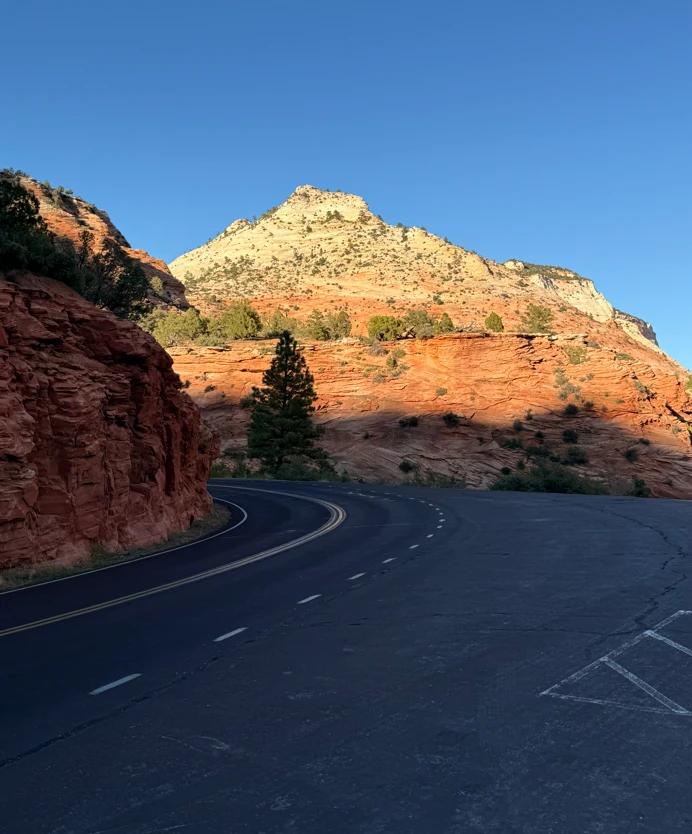
Check for construction. UDOT has had work and delays on SR-9 between Hurricane and Springdale. Before you leave, look at UDOT’s Zion-area road information page, which also covers the Virgin park-and-ride if you’d rather leave your car before Springdale.
Getting into Zion Canyon: parking and shuttle timing
Driving to the gate is the easy part. Parking is what decides your morning.
- Visitor center parking inside the south entrance often fills by about 9 a.m. from spring through fall, according to the park. In March, spring break crowds run about three times February’s numbers.
- Springdale’s paid lots are the backup. If you park in town, ride the free Springdale shuttle to the pedestrian entrance.
- The Zion Canyon shuttle runs March 7 through November 28 in 2026, plus December 26 through January 2. The first bus leaves at 7 a.m. During shuttle season, the Zion Canyon Scenic Drive is closed to private cars, so the shuttle is how you reach trailheads like The Narrows and Angels Landing.
- Last buses leave the visitor center between 5 and 7 p.m. depending on the season, so check the schedule before a long hike.
Our rule of thumb for guests: leave Apple Valley around 6:30 to 7 a.m. in busy months. You’ll be parked and on an early shuttle while most people are still in the entrance line. In winter, outside shuttle season, you can usually drive the Scenic Drive yourself and a later start is fine.
A private vehicle pass costs $35 for seven days. Buy it online ahead of time, and check the Zion National Park website for current fees, shuttle dates and any closures. Our guide on how many days to spend in Zion can help you decide how many of these early mornings to plan.
Kolob Canyons: the closest entrance, and the quietest
Kolob Canyons is Zion’s northwest section, and it’s a separate area with its own entrance and visitor center off I-15 at exit 40. It doesn’t connect by road to Zion Canyon. From Apple Valley, head through Hurricane and La Verkin to I-15 north, then take exit 40. It’s about 45 minutes.
The Kolob Canyons Road climbs about 5 miles to Timber Creek Overlook, with red “finger canyons” on both sides. The Taylor Creek trail is the main hike, about 5 miles round trip. There’s no shuttle, and you’ll see a fraction of the people you’d meet in Zion Canyon. Your Zion pass covers it. Our Kolob Canyons guide has the trail details.

The road is open most of the year but can close during winter storms. It’s a smart pick for a half day, for a crowded holiday weekend, or for the afternoon you arrive.
The east entrance and the Zion–Mount Carmel Highway
To reach the east side of Zion from Apple Valley, you drive in through the south entrance and follow the Zion–Mount Carmel Highway up the switchbacks and through the 1.1-mile tunnel. It’s about 1 hour 20 minutes to the east entrance. Along the way are Checkerboard Mesa, slickrock pullouts and the short Canyon Overlook Trail, one of the best views in the park for very little effort.

Large vehicles can’t use this road. Since June 7, 2026, vehicles over 35 feet 9 inches long, 7 feet 10 inches wide or 11 feet 4 inches tall, or over 50,000 pounds, are banned between Canyon Junction and the east entrance. Combinations can’t exceed 50 feet overall. The old tunnel escort system is gone. Bikes, e-bikes and pedestrians aren’t allowed in the tunnel either. Details are on the NPS large-vehicle page.
If you’re towing or driving a big rig and need the east side, go around: UT-59 runs southeast through Hildale to the Arizona line, Arizona highways continue through Fredonia to Kanab, and from Kanab US-89 heads north to Mount Carmel Junction and UT-9 west to the east entrance. It’s a longer drive, so plan it as part of a Kanab or Bryce day rather than a quick hop.
Smithsonian Butte Byway: a dry-weather scenic alternative
Look at a map and you’ll notice a dirt road heading north from UT-59 at Big Plain Junction, near Apple Valley, straight toward Rockville. That’s the Smithsonian Butte National Back Country Byway, managed by the BLM. It’s about 9 miles of unpaved road with views of Smithsonian Butte and the Zion skyline, and it passes the side road to Grafton ghost town.
It’s a beautiful drive. It is not our default route to Zion, and here’s why:
- It isn’t faster. The Federal Highway Administration puts the dirt section alone at about 45 minutes. Add the drive to the junction and the few miles from Rockville into Springdale, and you’re no better off than on the paved route.
- It has a steep, rough grade. The descent from the mesa down to Grafton Road isn’t recommended for low-clearance vehicles, RVs or trailers.
- It turns impassable in bad weather. The BLM says the byway often becomes impassable during heavy rain and winter storms, and it can be badly rutted afterward.
- There are no services. No fuel, water or restrooms.
If the weather has been dry for days and you have a high-clearance vehicle, it makes a great slow drive home after a Zion day, with a stop at Grafton. From Rockville, cross the historic one-lane Rockville Bridge on Bridge Road, turn right on Grafton Road, then left onto the byway. Otherwise, stick to the pavement. Rental car agreements often prohibit unpaved roads, so check yours.
Which route and entrance should you use?
- First visit, Angels Landing, The Narrows, Emerald Pools: south entrance via UT-59 and UT-9. Leave early.
- Crowded weekend or a half-day outing: Kolob Canyons.
- Canyon Overlook, Checkerboard Mesa or heading on to Bryce: east side through the tunnel, in a standard-size vehicle.
- RV or trailer going east: around through Kanab.
- A slow scenic loop on a dry afternoon: the Smithsonian Butte Byway, high clearance only.
For more ideas closer to home, our list of things to do near Apple Valley covers the mesas, state parks and dark skies within an hour of the cabins.
Making the drive work from a cabin base
The trade for the extra half hour compared with Springdale is what you come home to. Most guests do an early Zion day, stop in Hurricane for groceries on the way back, then spend the evening at the fire pit or in the hot tub under a dark sky. On a longer trip, mix in a Kolob Canyons or Sand Hollow day so you aren’t driving UT-9 every morning. Our comparison of where to stay near Zion lays out that trade honestly.
When you’re ready, check live availability for our four cabins and book direct. We’ll send the door code the morning you arrive, and you’ll be on UT-59 heading for Zion the next morning.
Frequently asked questions
How long is the drive from Apple Valley, Utah to Zion National Park?
Which Zion entrance is closest to Apple Valley?
Can you take Smithsonian Butte Road from Apple Valley to Zion?
Can I drive an RV from Apple Valley to Zion's east entrance?
What time should I leave Apple Valley to get parking at Zion?

About the authors
This guide comes from the team at Anasazi Cliffs Lodging, four private desert cabins in Apple Valley, Utah, run by local hosts Robert and Maria. We help guests plan Zion, Gooseberry Mesa and Southern Utah days every week, and we update these guides when rules and conditions change.