
Getting to Gooseberry Mesa: Road Conditions, Vehicle Access, and Directions From Apple Valley
The road to Gooseberry Mesa is about 6 miles of unpaved, often rutted dirt from UT-59 in Apple Valley. Here's the turn-by-turn, what vehicle you need, and what to do after rain.

In this guide
- Directions to Gooseberry Mesa from UT-59
- What the road is like
- Driving tips for the dirt
- Coming from farther away
- Which vehicles can make it
- Why Gooseberry Mesa roads become impassable when wet
- What to do after rain
- Trailheads and facilities
- Before you go: a quick checklist
- Leave no trace on the mesa
- A base close to the mesa
Gooseberry Mesa road conditions come down to one thing: it’s about 6 miles of unpaved, often rutted dirt from UT-59 in Apple Valley to the main trailhead. The BLM recommends high-clearance or 4WD vehicles, and the road can be impassable during or shortly after rain or snow. In dry weather, with the right vehicle, it’s a slow but straightforward drive.
Our cabins are in Apple Valley, along UT-59, so we see this road in every kind of weather and hear about it from riders every season. This guide covers the BLM’s directions, what to drive, why wet weather shuts it down, and what you’ll find (and won’t) at the trailheads. For the rides themselves, see our two-wheel experiences near Zion.
Directions to Gooseberry Mesa from UT-59
The BLM’s preferred route onto Gooseberry Mesa is from Highway 59 via Apple Valley. These are the BLM’s mileages from the Gooseberry Mesa National Recreation Trail page:
- Get to UT-59. From Hurricane, take State Route 59 east up the Hurricane Cliffs toward Apple Valley. From our cabins, you’re already on this stretch.
- Turn north onto the Smithsonian Butte Byway at Big Plain Junction in Apple Valley. The BLM’s byway page describes this as turning north onto Main Street.
- Drive about 2.8 miles on the byway, then turn left.
- Travel northwest about 3.3 miles to the Gooseberry Trailhead.
- Choose your trailhead:
- White Trailhead: turn left at the Gooseberry Trailhead and go about 1.3 miles west.
- Windmill Trailhead: continue straight about 1.2 miles.
From our cabins, the whole trip takes about 25 to 30 minutes, and most of that time is spent on the dirt. Don’t trust your phone’s estimate for the unpaved part. Drive it at the speed the ruts allow.
The Smithsonian Butte Byway continues north past the Gooseberry turnoff to Grafton and Rockville. You don’t need that section to reach the mesa, and its steep grade near Grafton isn’t recommended for low-clearance vehicles, RVs or trailers.
What the road is like
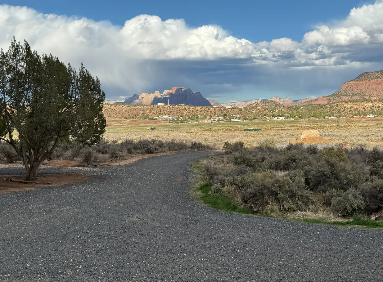
The BLM’s map is blunt: “The access road to Gooseberry Mesa is unpaved and frequently experiences rutting and washing out. High-clearance or 4WD vehicles are recommended.”
In practice, expect:
- Ruts and washouts that change after every big storm.
- Rocky, uneven sections where ground clearance matters more than horsepower.
- Sand and loose patches in places.
- Slow going. Plan on low speeds the whole way.
The first stretch of the byway from UT-59, toward the Wire Mesa trailhead, is suitable for most vehicles when dry. The road past the Gooseberry turnoff is where low cars start scraping.

Driving tips for the dirt
A few habits make the drive easier on you and the road:
- Go slow and keep steady momentum. Most damage happens when drivers rush the rough spots or spin their tires on a climb.
- Straddle the ruts rather than dropping a wheel into them, and keep your tires on the high ground where you can.
- Scout on foot. If a washout looks deep, get out and look before you commit. It takes two minutes and can save a tow.
- Stay on the road surface. Don’t make a new line around a bad patch. That’s how roads out here get wider and rougher every year.
- Leave room for others. Riders on bikes use this road too, and dust hangs in the air on calm days.
Coming from farther away
If you’re driving in from St. George or Las Vegas, it’s worth timing your arrival so you reach the dirt in daylight. St. George is about 45 minutes from Apple Valley, and Hurricane is about 17 minutes. Fill your tank and your water jugs in Hurricane, since there are no services on the byway or the mesa.
Which vehicles can make it
| Vehicle | Dry road | Wet or recently wet road |
|---|---|---|
| High-clearance 4WD or AWD SUV or truck | Recommended by the BLM | Don’t go |
| Crossover or AWD wagon | Possible with care; ruts can be a problem | Don’t go |
| Low-clearance sedan | Not recommended | Don’t go |
| RV, long van or trailer | Not recommended | Don’t go |
A few notes from experience. Rental car contracts often prohibit unpaved roads, so read yours before you go. Carry a full-size spare if you have one and know how to change it. And if you’re towing, leave the trailer in town.
Why Gooseberry Mesa roads become impassable when wet
Dry, the dirt here is hard-packed and drivable. Add water and it turns slick and sticky: tires lose traction, mud packs into wheel wells, and a gentle grade becomes something you slide down rather than drive up. The BLM’s White Trail page says that “during or shortly after inclement weather, Smithsonian Butte and the trailhead access road may be impassable,” and the byway page says the route often becomes impassable during heavy rain and winter weather.
Driving it wet also does damage. Every vehicle that pushes through mud leaves deep ruts that bake hard when the sun comes out, which is a big part of why the road is so rough.
What to do after rain
- Wait. How long depends on how much fell. A light shower may dry quickly; a soaking storm or snowmelt can keep the road soft for days.
- Look before you commit. If the surface sticks to your shoes or you see standing water in the ruts, turn around while you can.
- Watch the sky while you’re up there. Summer thunderstorms build fast. If a storm is heading your way, it can be smarter to drive out early than to get caught on the far side of a wet road.
- Have a plan B. On wet days, ride paved routes or let the trails dry. Riding muddy singletrack damages it too, and wet slickrock is slick.
Our month-by-month guide to the best time to ride Gooseberry and Hurricane covers which seasons bring the most rain.
Trailheads and facilities
The BLM directions name three trailheads:
- Gooseberry Trailhead: the first one you reach, where the road splits.
- White Trailhead: 1.3 miles west. The start of the White Trail, a roughly 3.1-mile two-track and singletrack route rated easiest by the BLM.
- Windmill Trailhead: 1.2 miles straight on, farther out the mesa. Check the BLM map for which trails connect from here before planning a longer ride like the Gooseberry Big Loop.
Facilities are minimal. There’s no water anywhere on the mesa, and you shouldn’t count on a restroom. Motorized use is allowed only on the White Trail and designated roads; all other trails on Gooseberry are non-motorized. That also means e-bikes are limited to the White Trail and roads unless the BLM says otherwise.

Before you go: a quick checklist
- Check the forecast and recent rain. If it rained hard in the last day or two, expect trouble.
- Check with the BLM St. George Field Office (435-688-3200) for closures, fire restrictions and notices.
- Fill up on water in town. Bring more than you think you need, for riding and for the drive.
- Download your map. Cell coverage varies by carrier and is patchy on the mesa. At our cabins, AT&T and T-Mobile generally work; Verizon is spotty.
- Tell someone your plan and when you’ll be back.
- Pack for a breakdown: spare tire, tire tools, a shovel if you have one, food, layers.
Leave no trace on the mesa
Gooseberry is a mix of BLM, state and private land. Stay on designated roads and don’t drive around ruts or puddles, which widens the road and crushes the desert’s living soil crust. Pack out all trash, campers included, and use existing pullouts for parking. If you’re thinking about staying the night on the mesa, our guide to Gooseberry Mesa camping vs. a cabin covers the BLM camping rules.
A base close to the mesa
Riders like Apple Valley because the paved highway gets you most of the way, and the drive home ends on a maintained gravel road any standard car can handle. After a long day on the slickrock, our cabins have hot showers, fast Wi-Fi to check the radar for tomorrow, and fire pits with free firewood. See which cabins are open and book direct.
Frequently asked questions
Do you need 4WD to get to Gooseberry Mesa?
How do you get to Gooseberry Mesa from Apple Valley?
Is the Gooseberry Mesa road passable after rain?
Is there water or a bathroom at Gooseberry Mesa?
Is there cell service on Gooseberry Mesa?

About the authors
This guide comes from the team at Anasazi Cliffs Lodging, four private desert cabins in Apple Valley, Utah, run by local hosts Robert and Maria. We help guests plan Zion, Gooseberry Mesa and Southern Utah days every week, and we update these guides when rules and conditions change.


